 English


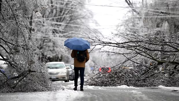
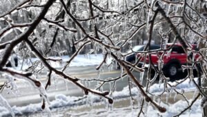
Toronto and the surrounding GTA are preparing for a major storm this weekend, with meteorologists warning of freezing rain, ice buildup, and hazardous road conditions.
A special weather statement remains in effect for Toronto, while York and Durham regions face freezing rain warnings. Experts predict rain will begin Friday evening, transitioning to freezing rain as temperatures hover near the freezing mark.
Hazardous Driving Conditions Expected
Authorities are urging drivers to exercise caution. Ontario Provincial Police (OPP) Sgt. Kerry Schmidt warned that ice could accumulate rapidly, making roads treacherous.
“Surfaces may appear wet but could be completely iced over,” Schmidt said, noting the risk of ice-laden trees falling in rural areas. CP24 Meteorologist Bill Coulter advised against travel to regions north of the city, including Georgian Bay, Kawartha Lakes, and the Ottawa Valley, where up to five millimeters of ice accretion could lead to road closures and power outages.
Toronto Opens Warming Centres
With temperatures set to dip below freezing, Toronto will open five warming centers starting Friday at 5 p.m. Meanwhile, Ajax and Richmond Hill have declared “significant weather events,” warning residents that winter maintenance services may be delayed.
Storm Timeline and Outlook
The freezing rain is expected to ease by midday Sunday, though some areas at higher elevations may see prolonged icy conditions. Saturday is expected to bring alternating periods of freezing rain and mixed showers before temperatures rise on Monday.
By next week, Toronto could see highs of 12°C on Monday and 14°C by Thursday. Climatologist Dave Phillips summed up the storm’s potential impact, saying:
“Let’s hope this is winter’s last hurrah.”


