 English


“compiled: Elmili TK”
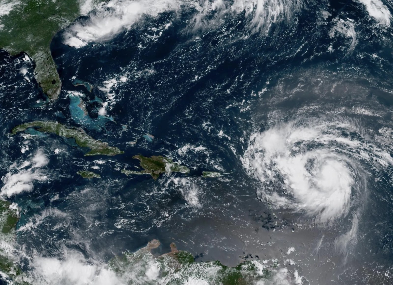
SAN JUAN, Puerto Rico — Hurricane Erin Category 4 gained strength in the Caribbean on Saturday, according to the U.S. National Hurricane Center. The powerful storm is intensifying quickly and raising concerns across the region.
Storm Path and Strength
Hurricane Erin Category 4 currently sits about 150 miles (240 kilometers) northeast of Anguilla. Winds have reached 145 mph (230 km/h), making it a Category 4 hurricane. The system is moving west-northwest at 20 mph (31 km/h).
Forecasters say Erin will not directly hit land. However, strong outer winds already affect nearby islands. Heavy rainfall may trigger flooding, mudslides, and landslides. The storm will eventually curve away from the U.S. mainland, but its exact track remains uncertain.
Watches and Regional Alerts
Tropical storm watches are active for St. Martin, St. Barts, and St. Maarten. Meteorologists expect outer bands to bring rain to the Virgin Islands, Puerto Rico, and the northern Leeward Islands through Sunday.
Michael Lowry, hurricane specialist, noted Erin could shift northeast, moving between Bermuda and the U.S. coast. “It looks safe for the U.S. mainland, but Bermuda must stay alert,” he said.
Warm Waters Fuel Rapid Growth
Experts say warm Atlantic waters are driving Erin’s explosive growth. Alex DaSilva, Accuweather’s lead hurricane expert, explained that sea temperatures are several degrees above average. These conditions allow the storm to gain energy and expand in size. Rough seas across the western Atlantic are expected in the coming days.
Busy Hurricane Season
Erin is the fifth named storm of the Atlantic season, but the first to become a hurricane. The season runs from June 1 to November 30. Forecasters predict six to 10 hurricanes this year, with up to five reaching major strength.
Local Preparations
Puerto Rico remains under a flood watch until Monday. Officials have inspected 367 shelters and stand ready to open them if needed. FEMA has already deployed 200 staff to the island. The U.S. Coast Guard closed six seaports in Puerto Rico and two in the Virgin Islands.
Meanwhile, Bahamian officials prepared shelters and urged residents to track the storm closely. “These storms can shift suddenly,” warned Aarone Sargent of the Bahamas disaster authority.


